Winter forecast 2025-26: will La Niña bring more snow?
Will the 2025-26 ski season be snowier than the last in Western Canada? As always, predicting the future is hard, especially at longer time scales involving something as complex as our climate system with its many moving parts.
Last year, La Niña entertained Western Canada's flirtations mostly from afar. This coming season, the long-range snow forecast may hold a little more hope. Let's dive in.
Long range forecast 2025-26 Western Canada ski season
To take a skillful look at what may be in store for this coming winter season, we must look at several different phenomena throughout our Earth and atmosphere, both near and far.

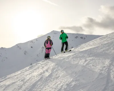
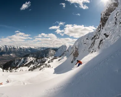
Photo:
Steve MacNaull
Could La Niña bring snowy days like this to Western Canada? The long-range snow forecast for 2025-26 gives reason to hope.
This includes everything from the surface temperature of the Pacific in different areas across the ocean basin, to thunderstorm patterns in the tropics, to the direction the winds are blowing in the stratosphere above the equator.
Weak La Niña forecast to emerge this winter
One of the major drivers of climate variation in the Earth system is the El Niño - Southern Oscillation (ENSO) pattern, which describes sea surface temperature patterns in the tropical Pacific Ocean, and how they differ from normal. These affect wind and thunderstorm patterns in the tropics that can influence weather conditions thousands of kilometres away.
During the cool phase, or La Niña, colder than normal sea surface temperatures exist across the central and eastern tropical Pacific Ocean.
This tends to cause cooler than normal winters across western Canada, with more snowfall than normal in the interior mountains of British Columbia and Alberta. But no ENSO event is the same, and some La Niña winters fail to deliver.

Photo:
National Oceanic and Atmospheric Administration
North American weather patterns associated with a typical La Niña.
When the pattern is strong, influences on global weather patterns are stronger, improving the predictability of the season.
This year, forecasters at the Climate Prediction Center in the United States are calling for a weak La Niña toward the end of fall, lasting only a few months at most.
score better snow days with SnowSeekers
sign up for the FREE newsletter that gets you into the snow
This may reduce its impact on our weather, especially given other, closer sea surface temperature patterns in the north Pacific Ocean that may overwhelm the tropical signal. Sea surface temperatures across the north Pacific are extremely warm right now, which could significantly influence our winter weather in either direction.
For instance, it could increase the amount of moisture available to storm systems moving into western Canada, causing episodes of significant precipitation.
But it could also cause a persistent high-pressure system to form over Alaska, blocking Pacific moisture and leaving most of British Columbia and Alberta dry.

Photo:
National Oceanic and Atmospheric Administration
Global sea surface temperature anomaly (difference from normal. Notice the colder than normal conditions associated with a developing La Niña in the tropical Pacific Ocean, along with significantly warmer than normal temperatures across the north Pacific,
Still, La Niña conditions in the tropics will likely energize a cyclical pattern of tropical thunderstorms that moves from west to east throughout the winter, which can trigger plumes of moisture at times that flow toward the west coast of North America, bringing heavy precipitation across the mountains.
And this pattern could further be reinforced by easterly winds high in the tropical stratosphere.
But these same stratospheric winds could also lead to a weaker and more unstable Polar Vortex, bringing a risk of significant periods of cold through the winter, and associated upslope snow events.
So, what do the long-range models show?
Long-range model blends from various government agencies are predicting a warm, slow start to fall across western Canada, with increasing wet weather across southern British Columbia.
This is especially true along the coast, where an active jet stream could bring moist systems across the mountains, delivering abundant rain and high-elevation snow.
By winter, model blends shift toward favouring a more classic La Niña-type pattern, with colder than normal conditions across western Canada, and more snow than normal throughout the mountain ranges of British Columbia and Alberta.
The bottom line
Given forecast La Niña conditions and the possibility of a weaker Polar Vortex, winter should trend colder than normal with the potential of some significant, cold Arctic outbreaks.

Photo:
Copernicus Climate Change Service
Forecast precipitation anomaly (difference from normal) for the period for December 2025 to February 2026, showing above normal precipitation associated with a classic La Nina-type pattern in western Canada and the northwestern United States.
These may also be accompanied by upslope snow events. On the other hand, warm, moist Pacific systems energized by warm ocean temperatures may also occur at times, bringing heavy precipitation events across the west with higher freezing levels.
All of this is to suggest that there is a higher confidence in wetter than normal conditions across the mountains of western Canada than last winter.
The important caveat here is that skill in long-range precipitation forecasts remains significantly low.
So, expect a slow start to fall, with periods of wet weather likely beginning across the mountains of southern British Columbia by October.
By late November, a more classic La Niña winter could take hold, tilting the season colder than normal—with periods of very cold weather and heavy snow at times.
Here's to a snowier winter than last! Keep doing those snow dances.
Kyle Brittain is an Alberta weather specialist and SnowSeekers correspondent, who has a passion for studying "bad weather" i.e. storms i.e. good weather for skiers and snowboarders. Follow along on his Instagram here.
More good weather vibes
Stoked for snow? Get ready to go with SnowSeekers #morecowbell